WORKS/BLOGS
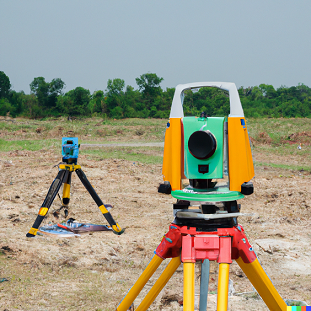
What is Digital Land Surveying?
Digital land surveying uses advanced technologies like GPS, drones, and 3D laser scanning to collect precise land measurements and create detailed maps. Unlike traditional methods that relied on manual tools and processes, digital surveying allows for faster data collection, improved accuracy, and comprehensive analysis.
Key Benefits of Digital Land Surveying
- Unmatched Accuracy: With tools like GPS and Total Stations, digital surveys minimize errors, ensuring precise boundary markings and land measurements.
- Time Efficiency: Digital methods significantly reduce survey time, enabling quicker project initiation and completion.
- Enhanced Visualization: Technologies like 3D modeling provide detailed visuals of the surveyed area, helping stakeholders better understand the land’s potential.
- Cost-Effective: Faster processes and accurate results mean fewer errors and reduced rework, saving time and money.
- Data Integration: Survey data can be seamlessly integrated with GIS systems, offering valuable insights for planning and decision-making.
Applications of Digital Land Surveying
Digital surveying is used across industries, from urban planning and infrastructure development to agriculture and environmental management. Whether it’s mapping complex terrains for a highway project or designing layouts for residential developments, digital tools ensure every detail is captured with precision.
The Future of Land Surveying
As technology evolves, the field of digital land surveying continues to innovate. AI-powered analysis, drone mapping, and cloud-based data storage are paving the way for smarter, more efficient surveying practices. For landowners, developers, and survey professionals, staying ahead with these tools is no longer a luxury—it’s a necessity.
Digital land surveying is transforming the way we interact with our environment. By leveraging advanced technology, we can ensure accurate, efficient, and sustainable land use, driving progress and development into the future.
ডিজিটাল ভূমি জরিপ কী?
ডিজিটাল ভূমি জরিপে জিপিএস, ড্রোন এবং ৩ডি লেজার স্ক্যানিংয়ের মতো উন্নত প্রযুক্তি ব্যবহার করে সুনির্দিষ্ট ভূমি পরিমাপ ও বিস্তারিত মানচিত্র তৈরি করা হয়। প্রথাগত পদ্ধতিতে যেখানে ম্যানুয়াল টুল ও প্রক্রিয়ার উপর নির্ভর করা হতো, ডিজিটাল জরিপ সেই তুলনায় দ্রুততর তথ্য সংগ্রহ, উন্নত সঠিকতা এবং বিস্তৃত বিশ্লেষণ নিশ্চিত করে।
ডিজিটাল ভূমি জরিপের মূল সুবিধাগুলো
১. অতুলনীয় সঠিকতা
জিপিএস এবং টোটাল স্টেশনের মতো সরঞ্জামের মাধ্যমে ডিজিটাল জরিপে ভুলের সম্ভাবনা কমে যায় এবং সুনির্দিষ্ট সীমানা নির্ধারণ ও ভূমি পরিমাপ নিশ্চিত হয়।
২. সময়ের সাশ্রয়
ডিজিটাল পদ্ধতিতে জরিপের সময় উল্লেখযোগ্যভাবে কমে যায়, যা দ্রুত প্রকল্প শুরু এবং সমাপ্তি সম্ভব করে।
৩. উন্নত ভিজ্যুয়ালাইজেশন
৩ডি মডেলিং প্রযুক্তি ব্যবহার করে জরিপ করা এলাকাগুলোর বিস্তারিত চিত্র সরবরাহ করা হয়, যা ভূমির সম্ভাবনা সম্পর্কে অংশীদারদের ভালোভাবে বুঝতে সহায়তা করে।
৪. খরচ-সাশ্রয়ী
দ্রুত প্রক্রিয়া এবং নির্ভুল ফলাফলের কারণে ত্রুটি কম হয় এবং পুনরায় কাজ করার প্রয়োজনীয়তা হ্রাস পায়, ফলে সময় এবং অর্থ সাশ্রয় হয়।
৫. ডেটা ইন্টিগ্রেশন
জরিপের তথ্য সহজেই জিআইএস (GIS) সিস্টেমে একীভূত করা যায়, যা পরিকল্পনা এবং সিদ্ধান্ত গ্রহণের জন্য মূল্যবান অন্তর্দৃষ্টি প্রদান করে।
ডিজিটাল ভূমি জরিপের ব্যবহার
ডিজিটাল ভূমি জরিপ নগর পরিকল্পনা ও অবকাঠামো উন্নয়ন থেকে শুরু করে কৃষি এবং পরিবেশ ব্যবস্থাপনায় ব্যবহার করা হয়। এটি মহাসড়ক প্রকল্পের জন্য জটিল ভূখণ্ডের মানচিত্র তৈরি করা হোক বা আবাসিক এলাকার নকশা ডিজাইন করা হোক, ডিজিটাল সরঞ্জাম প্রতিটি বিবরণ নিখুঁতভাবে নিশ্চিত করে।
ভূমি জরিপের ভবিষ্যৎ
প্রযুক্তি ক্রমাগত উন্নত হওয়ার সাথে সাথে ডিজিটাল ভূমি জরিপের ক্ষেত্রেও নতুন উদ্ভাবন যুক্ত হচ্ছে। এআই (AI)-চালিত বিশ্লেষণ, ড্রোন ম্যাপিং এবং ক্লাউড-ভিত্তিক ডেটা সংরক্ষণ স্মার্ট ও আরও কার্যকরী জরিপ পদ্ধতির পথ তৈরি করছে। জমির মালিক, বিকাশকারী এবং জরিপ পেশাদারদের জন্য এই সরঞ্জামগুলোর সঙ্গে তাল মিলিয়ে চলা আর বিলাসিতা নয়, বরং অপরিহার্য হয়ে উঠেছে।
ডিজিটাল ভূমি জরিপ আমাদের পরিবেশের সাথে সম্পর্ক স্থাপনের পদ্ধতিকে রূপান্তরিত করছে। উন্নত প্রযুক্তি ব্যবহার করে আমরা আরও সঠিক, কার্যকরী এবং টেকসই ভূমি ব্যবহার নিশ্চিত করতে পারি, যা ভবিষ্যতে অগ্রগতি ও উন্নয়ন চালিত করবে।
What is Soil Testing?
Soil testing involves analyzing soil samples to determine their physical, chemical, and biological properties. This process helps identify key factors like soil strength, moisture content, pH levels, nutrient availability, and the presence of contaminants.
Why is Soil Testing Important?
1. In Construction
- Foundation Stability: Soil testing determines the bearing capacity of the soil, ensuring the foundation can support the structure’s weight.
- Soil Type Identification: Identifying soil types, such as clay, sand, or silt, helps engineers design appropriate foundations and drainage systems.
- Moisture and Compaction: Testing reveals soil moisture content and compaction levels, which are crucial for preventing settlement or shifting of the structure.
- Risk Mitigation: Identifying issues like soil shrinkage, swelling, or contamination ensures that potential risks are addressed before construction begins.
2. In Agriculture
- Nutrient Management: Soil testing helps farmers understand nutrient deficiencies and apply the right fertilizers to improve crop yield.
- pH Balancing: Knowing the soil’s pH helps determine the best crops to grow and ensures plants can absorb essential nutrients.
- Water Retention: Testing reveals the soil’s water-holding capacity, helping in efficient irrigation planning.
- Environmental Protection: By identifying contaminants or excessive nutrient levels, soil testing helps prevent pollution and degradation of farmland.
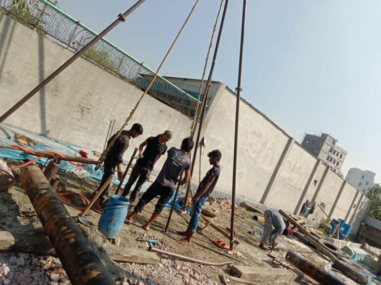
How Soil Testing Works
- Sample Collection: Soil samples are collected from various depths and locations.
- Laboratory Analysis: Samples are analyzed for properties like texture, pH, organic matter, minerals, and contaminants.
- Reporting and Recommendations: Based on the results, experts provide guidance on soil improvement or necessary precautions.
Applications of Soil Testing
- Construction Projects: Buildings, roads, bridges, and dams rely on soil testing for safety and durability.
- Landscaping: Soil analysis ensures healthy plant growth in gardens and parks.
- Irrigation Systems: Understanding soil water retention helps design efficient irrigation systems.
- Environmental Monitoring: Testing helps identify pollution levels and soil restoration needs.
Conclusion
Soil testing is a small investment with massive returns. Whether you’re constructing a skyscraper or planting crops, understanding the soil beneath ensures safety, efficiency, and long-term success. By prioritizing soil testing, you can build stronger structures, grow healthier crops, and contribute to sustainable land use.
মাটির পরীক্ষা কী?
মাটির পরীক্ষা হলো মাটির নমুনা বিশ্লেষণ করার একটি প্রক্রিয়া, যার মাধ্যমে এর শারীরিক, রাসায়নিক এবং জৈবিক বৈশিষ্ট্য নির্ধারণ করা হয়। এই প্রক্রিয়াটি মাটির শক্তি, আর্দ্রতা, পিএইচ মান, পুষ্টি উপাদানের প্রাপ্যতা এবং দূষণের উপস্থিতি সম্পর্কে তথ্য প্রদান করে।
মাটির পরীক্ষা কেন গুরুত্বপূর্ণ?
১. নির্মাণে
- ভিত্তির স্থায়িত্ব নিশ্চিতকরণ: মাটির পরীক্ষার মাধ্যমে মাটির ভারবহন ক্ষমতা নির্ধারণ করা হয়, যা নিশ্চিত করে যে মাটি কাঠামোর ওজন বহন করতে পারবে।
- মাটির ধরন নির্ণয়: মাটি যেমন – মাটি দানা, বালু বা কাদা – সঠিকভাবে চিহ্নিত করা নির্মাণ প্রকল্পের জন্য উপযুক্ত ভিত্তি এবং নিষ্কাশন ব্যবস্থা তৈরি করতে সহায়ক।
- আর্দ্রতা ও কম্প্যাকশন: মাটির আর্দ্রতার পরিমাণ এবং সংক্ষেপণের মাত্রা নির্ধারণ করা গুরুত্বপূর্ণ, যা ভবিষ্যতে মাটির সরে যাওয়া বা কাঠামো বসে যাওয়া রোধ করে।
- ঝুঁকি হ্রাস: মাটির সঙ্কোচন, স্ফীতি বা দূষণের মতো বিষয় চিহ্নিত করে নির্মাণ শুরুর আগেই সমস্যা সমাধানের ব্যবস্থা করা যায়।
২. কৃষিতে
- পুষ্টি ব্যবস্থাপনা: মাটির পরীক্ষা কৃষকদের পুষ্টি ঘাটতি সম্পর্কে জানাতে এবং সঠিক সার প্রয়োগে ফসল উৎপাদন বাড়াতে সহায়তা করে।
- পিএইচ সামঞ্জস্য: মাটির পিএইচ মান জানা সঠিক ফসল নির্বাচন এবং উদ্ভিদের জন্য প্রয়োজনীয় পুষ্টি শোষণে সহায়ক।
- জলধারণ ক্ষমতা: মাটির জলধারণ ক্ষমতা সম্পর্কে ধারণা সঠিক সেচ পরিকল্পনায় সহায়ক।
- পরিবেশ সুরক্ষা: দূষণ বা অতিরিক্ত পুষ্টি উপাদান চিহ্নিত করার মাধ্যমে মাটির অবক্ষয় রোধ এবং পরিবেশ রক্ষা করা যায়।
মাটির পরীক্ষা কীভাবে করা হয়?
১. নমুনা সংগ্রহ: বিভিন্ন গভীরতা এবং অবস্থান থেকে মাটির নমুনা সংগ্রহ করা হয়।
২. ল্যাব বিশ্লেষণ: নমুনাগুলো মাটির গঠন, পিএইচ, জৈব পদার্থ, খনিজ এবং দূষণকারীর বৈশিষ্ট্য নির্ধারণের জন্য ল্যাবরেটরিতে পরীক্ষা করা হয়।
৩. প্রতিবেদন ও সুপারিশ: ফলাফলের উপর ভিত্তি করে বিশেষজ্ঞরা মাটি উন্নত করার জন্য দিকনির্দেশনা বা প্রয়োজনীয় সতর্কতা প্রদান করেন।
মাটির পরীক্ষার ব্যবহার
- নির্মাণ প্রকল্পে: ভবন, রাস্তা, সেতু এবং বাঁধের জন্য মাটির পরীক্ষা অত্যন্ত গুরুত্বপূর্ণ।
- ল্যান্ডস্কেপিংয়ে: উদ্যান ও পার্কে সুস্থ গাছপালা নিশ্চিত করতে মাটির বিশ্লেষণ করা হয়।
- সেচ ব্যবস্থায়: মাটির জলধারণ ক্ষমতা বুঝে কার্যকরী সেচ ব্যবস্থা তৈরি করা হয়।
- পরিবেশ পর্যবেক্ষণে: মাটির দূষণের মাত্রা নির্ধারণ এবং পুনরুদ্ধারের প্রয়োজনীয়তা নির্ধারণে মাটির পরীক্ষা সহায়ক।
উপসংহার
মাটির পরীক্ষা একটি ছোট বিনিয়োগ, কিন্তু এর ফলাফল অত্যন্ত বড়। আপনি যদি একটি ভবন নির্মাণ করেন বা ফসল চাষ করেন, মাটির বৈশিষ্ট্য সম্পর্কে সঠিক জ্ঞান দীর্ঘমেয়াদে সাফল্য নিশ্চিত করে। মাটির পরীক্ষা প্রাধান্য দিয়ে আপনি শক্তিশালী কাঠামো তৈরি, স্বাস্থ্যকর ফসল উৎপাদন এবং টেকসই ভূমি ব্যবহারে অবদান রাখতে পারেন।